Monday, July 27, 2009

MUSIM BUAH

Hujung minggu baru-baru ni, lepas pergi mendaki Broga Hill di Semenyih, aku balik kampung. Dah lama sangat tak balik kampung, Mak pun tertanya-tanya bila aku nak balik ambik buah. Musim buah dah nak sampai penghujungnya tapi ada pokok yang masih lebat dengan buah sebab tidak ada siapa yang petik.

Jadi tugas aku yang pertama pada hari Ahad adalah untuk memanjat pokok manggis. Memanjat pokok manggis adalah mudah sebab ia banyak dahan dan dahan-dahannya pun liat. Kira bolehlah menahan berat orang 72 kilo macam aku ni.

Dipendekkan cerita, inilah hasilnya, hasil kutipan solo aku!

Selain memanjat pokok manggis, Mak aku suruh pulak panjat pokok dokong. Tapi sayang seribu kali sayang, buah-buahnya banyak yang busuk dan merekah sebab hujan 3 hari sebelum tu. memang tak tahan lama punya dokong!

Pagi-pagi lagi Abang aku dah ke pasar minggu cari buah durian. Buah durian kami dah habis gugur, musim dah habis. Sampai je Abang aku ke rumah dengan durian kampung, apa lagi makanlah durian untuk breakfast! Kira dah murah dah kat sini sebab harganya RM2 sekilo.

Lepas aktiviti makan durian, pergi dusun Mak Cik aku pergi panjat pokok langsat. Aduh Mak! Rasa nak pitam aku dibuatnya, bila dah sampai ke dahan tempat bergantung, terus berhenti sekejap menarik nafas. Pitam tak pitam, dapat jugaklah seguni buah langsat! Tapi sayang, gambar buah langsat yang aku petik tak ada! Lupa lah pulak!

Masa panjat pokok langsat, aku dapat tahu dari Abang aku yang dia dah mendaki Gunung Ledang 12 kali dan Gunung Kinabalu 2 kali, Gunung Jerai tak ingat dah berapa kali sebab dia duduk di Kedah! Malahan dia adalah 'certified guide and trainer'. Ciss! tak pernah dia nak ajak aku selama ni. Tapi sekarang dia dah pencen mendaki dan pencen kerja jugak. Nantilah kalau aku ke Kedah nanti aku nak ambil peralatan camping dia!

Dah banyak kali naik gunung ni, rasa sakit badan tak ada lah bila panjat pokok tapi keletihan dan tenaga yang diguna boleh tahan jugak! Satu jam panjat pokok dekat nak lencun T-shirt aku! Dah habih panjat pokok langsat, Abang aku pergi mencatas dahan rambutan pulak. Kena sambung kerja lagi, mengemas dan memilih buah untuk dimakan. Dah tu dahan rambutan ni pulak banyak kerengga! Nasib baik lah aku pakai shorts aje, senang nak bunuh kerengga tu! Abang ipar aku pakai seluar panjang, puas kerengga betina tu jalan merata-rata dalam seluar dia dan pasti ada yang pengsan!

Gambar bawah ni, sebahagian dari buah rambutan yang kami dapat!


Gambar bawah ni pulak, gambar rambai yang belum cukup masak. Kami ambil bukan untuk dimakan tapi ambil kulitnya dan keringkan. Kulit rambai yang kering tu kamu akan gunakan untuk masak lomak cili api dengan ayam ke, sardin ke! Sodap Jang!


Itulah dia aktiviti hujung minggu aku lepas bersiar-siar di Broga Hill! Just as fun and enjoyable!

Wednesday, July 22, 2009

PINE TREE HILL


I thought Gunung Nuang is my last hiking trip for mountains above 800 meters before leaving for Mt. Kinabalu next month. I had already planned for hiking trips with friends and colleagues on Jul 26 (Broga Hill) and Aug 8 (Bukit Tabur). However, I have nothing planned on Aug 1.

I have options between Gunung Bunga Buah (Genting), Gunung Datuk (Rembau) and Pine Tree Hill. I've been to Gunung Datuk and I will go there again, may be next year. And that left me with two choices, Pine Tree Hill or Gunung Bunga Buah.

I was told that the trail for Gunung Bunga Buah is not clear and there are a lot of leeches there even though during the current dry season! I don't have that much of info about this mountain as well. All I know is the starting point is behind Hotel Sri Malaysia and I am not sure whether permit is required or not. I heard it's required and the mountain is under the management of Genting group, it's a private property? Anyway, a Facebook contact told me that he joined Malaysian Nature Society's (MNS) trip hiking the mountain recently.

As for Pine Tree Hill, it's a 6 - 7 hours of hiking trip, located at Fraser's Hill, it's 1,447 meters/4,750 feet above sea level. I was told that the trail is clear, no permit required and of course the attraction of relaxing at Fraser's Hill after that. I have been to Gunung Gap and Ulu Semangkuk (the entrance is near Gap Rest House) and Pine Tree Hill is just nearby!

So, I made the decision, it's going to be Pine Tree Hill on Aug 1! Yeah!

Sunday, July 19, 2009

GUNUNG NUANG


Gunung Nuang
Located in Pangsun, Hulu Langat, Selangor, the infamous Gunung Nuang is 1,498 m/4,898 ft above sea level. It's the highest mountain in Selangor.

How to go there?
Very easy! From KL-Seremban highway, take MRR2 highway towards Genting and exit at Kajang/Cheras interchange. After paying the toll at Batu 9 toll gate, turn to the left to Jalan Hulu Langat. From there, be on the look out for Balai Polis on the right side near a traffic light. At the traffic light, turn to the left. From here, it's one straight road all the way and signboards are all over for directions to Hutan Lipur Gunung Nuang.

The terrain
The terrain is divided into four main Check points:
1. The never ending road!
2. Kem Lolo
3. Kem Pacat
4. Puncak Pengasih

Jul 18, 2009. Saturday
1. The never ending road!, 6.50am
It was 6.30am when I reached the parking lot of Hutan Lipur Gunung Nuang. After a short briefing by the group leader, we started our journey at 6.50am through the never ending road. It was still dark and it's a bamboo forest along the road. We had to walk fast along the road as later on we had to slower the pace as we started the ascending.


Kem Lolo, 8.45am
We reached Kem Lolo about two hours later after passing beautiful waterfalls of Lolo dam. Kem Lolo is a very popular spot for overnite campers. Quite a number of hikers camped overnite here too so that they can start the climb early! If they start at 7am, they are already 2 hours in front of us.

There's nothing interesting along the way and I was wondering what made Gunung Nuang so special until people say that once you've done Nuang, Gunung Kinabalu is not a problem. My curiosity was answered after we passed Kem Pacat.

At Kem Lolo, we turned to the left towards the next Check Point, Kem Pacat. There used to be a lot 'dancing queens' in this camp area, that's why it's known as Kem Pacat. It' didn't rain for a few days before this trip, so the campsite was dry. Instead of pacat, there were a lot of bees!


Kem Pacat, 10.25am
We reached Kem Pacat after almost 4 hours of trekking. Despite its name, no pacat (land leeches aka dancing queens) to be found here. It must be because it's dry. The fun really began here!

Here the trail became steeper and more rugged. We were hiking on red clay with exposed roots and fallen trees here and there. Good pair of hiking shoes with good grips are necessary. Otherwise, you'd end up being slowed down by shoe problem. It happened to us too as one hiker had shoe problem and had to continue descending barefooted.

And here, I knew what the mountain was infamous about! I prayed that it'd not rain, or else the red clay trail can be very slippery. Knowing my record of slipping on the way down, the thought that I might have to endure the slippery red clay chilled me to the bones!

I had fun here and really enjoyed the climb and this trail really defined what Gunung Nuang was all about and what made it different from the rest. Or else, the trail before that was all boring and it's more like 'been there and done that' kind of things.


Puncak Pengasih, 11.40am
Puncak Pengasih is also known as False Peak. Hikers may have got the idea that they have reached the peak here, but it's not. From here, take the trail to the left. It's a descending trail for about 20 minutes. We had to ascend again to the peak. A few meters before Puncak Pengasih, the air was already cooler and the surrounding was misty.
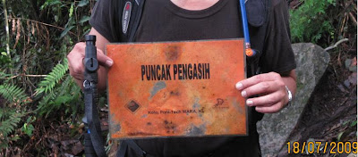


The Peak, 12.25pm
Yes! We made it to the peak in more than 5 hours. It was very misty and it looked it's gonna rain. I was worried!

During clear day, one could see Semenyih dam from here and the surrounding towns. The view is worth the endurance! But not today. It was very misty and cloudy. And cold too! Some of the hikers were taking out their kain pelikat and use it as blanket!

After about 15 minutes and after feeding a friendly squirrel we decided to come down leaving some of the group members there. Anyway, most of them hadn't reached the peak as yet when we left and met them on the way down.

We reached back the base at around 5.30pm passing through the same Check Points. And the never ending road seemed to have no end in sight!
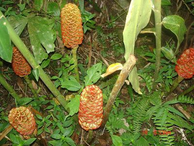

As a summary, I enjoyed the hiking experience here and I thanked God, Allah the Almighty for being able to complete the trip safely. I was also grateful to the group leaders who gave me the opportunity to join them on this trip.

Tuesday, July 14, 2009

GUNUNG LEDANG - ENJOYABLE CLIMB


I joined a group of people from Facebook to Gunung Ledang on Jul 11 and 12, 2009. Gunung Ledang is 1276 meters above sea level. Apparently, it's the 64th. tallest and 6th. most difficult in Malaysia! Is it true? These are facts that I can't verify and being painted at the toilet area.

How To Get There
This mountain is very popular and every Malaysians, young and old, may have heard about the legend, Puteri Gunung Ledang. It is situated in Tangkak, Johor. It's very easy to locate the place since it's a very popular spot for picnic and hiking enthusiasts.

From southbound PLUS highway, we exit at Tangkak (exit 235). Immediately after paying the toll fee, we came come across a T junction, we turned to the right turn towards Sagil. Along the way, there were signage giving us directions on how to get to the Gunung Ledang Resort. Nobody will miss it as it's a long straight road until we reached Pintu A of the resort.
Accomodation
There were options to choose from, from a cabin with no electricity to air-cond rooms. With the minimal fee that we paid to the organizers, we were put up at a cabin that can accommodate 4 people. We had to light mosquito coil to repel the insects! For information on the climbing and accommodation, please contact: Gunung Ledang Resort Sdn. Bhd. Tel No: 06-9772888, Fax No: 06-977 3555 and Email: ledang@tm.net.my (still got ah this kind of email address?)

The hiking
The mountain is under the Management of the resort and I have to say it's well maintained. I am not sure though how much the climbing permit was but I know about the deposit RM20 that we had to pay. And we had to sign a declaration form on things that we bring up to the mountain. The whole idea is for us not to litter the mountain. What you bring up, you must take it down, nothing should be left behind. That also reminds me of one axiom related to hiking, don't take anything but pictures and don't leave anything but footprints.

Anyway, the trail that we took was a new one. They had closed the trail from the resort itself. The Check Points under the new trails are:
  1. CP 1 - Bukit Semput
  2. CP 2 - Lagenda Trail
  3. CP 3 - Batu Orkid
  4. CP 5 - Sungei Segi Tiga (2,200 ft)
  5. CP 6 - Gua Kambing (3,050 ft) plus Batu Hampar and Taman Bonsai
  6. CP 7 - Botak Hill (3,650 ft)
  7. The Summit (4,187 ft)

It took us 5 hours to reach the summit. I have to say we could complete it in four hours. However, along the way we had to do at least 2 of 30 minutes wait for the slower group. Eventually the slowest group of 7 hikers had to return to the base as they couldn't face up to the challenges.


There were 33 of us and we were given 3 guides. By right, we should break up into smaller group after the first Check Point, depending on the speed, fast, medium and slow. And each guide will look after one group. However, that was not the case and we ended up waiting for tghe whole group to reach the next Check point before we continued.

Check point 1 - Bukit Semput

After the briefing by the Park Management's staff, we started our trekking to the first CP, Bukit Semput. The trek leading to Bukit Semput would really make an average fit guy like me and majority of us 'semput'. Semput is panting in English. We had to climb at least 725 concrete steps and by the time we reached CP1, we were all panting and sweating. As for me, I gulped at least 100 ml of 100 Plus.

Check Point 2 - Lagenda Trail

It was no better than CP 1 with the concrete steps missing. It's all the way up with steep terrains but not so rugged as compare to the later trail, Gua Kambing. The trail was very clean and well maintained.


Check Point 3 - Batu Orkid
At one time, the big rock next to our resting area must have got a lot of orchids. That's why the CP was known as Batu Orkid (Aku agak lah!). We had to wait for the slower group here too!


Check Point 5 - Sungei Segi Tiga

There are 3 streams that converged as one here, that's where it got its name. From here to Gua Kambing, the trail is called KFC (Killing Fitness Centre), the trail is tough, rugged and uphill all the way.


Check Point 6 - Gua Kambing
The most interesting Check Point. From here to Botak Hill, we passed through two interesting treks, Batu Hampar and Taman Bonsai (Bonsai Garden).


At Gua Kambing, you either pass through the cave (it's not actually a cave, it's just a narrow path in between rocks for hikers to pass through!). Don't fancy that, we had the option of going around the cave.


Batu Hampar, a rock face that is 4 storey high. Very high indeed and that the climbing using ropes is divided into two parts. It's a cliff, imagine you're in Cliffhanger dangling on rope! It's scary, adventurous and fun, depending on how you look at it. Nice scenery, id you're not scare to look behind! It's advisable to follow experienced hikers for this stretch or someone who can guide, help and lead the way.


Taman Bonsai - a good pay-off after completing Batu Hampar's climb. From here, it's already 3,000 ft above sea level. The vegetation are stunted and hardy.


Check Point 7 - Botak Hill
The last CP before reaching the summit. From here, there are two options, the longer route (very tough) or the shorter route. By accident, we (the fast group)turned to the left and took the longer trek. The trek is very tough, there are ropes and staircases to help through it.

Last Check Point - The Summit
We took the longer and tougher route and yet we became the first group to reach the summit. Wow! Breath taking view, 360 degrees of the surrounding valleys. The weather was cooler and we were above the clouds at times!


Summary
I enjoyed the climbing very much and the group was a fun bunch of people and I hope to join them again for other trekking activities next year!

Tuesday, July 7, 2009

GUNUNG LEDANG - CONFIRMED

It's officially ON! I'll be joining a group of trekkers to Gunung Ledang via Sagil on Jul 11 (this Saturday!). I was told there'd be a big group (40 people??) and I never met anyone of them.

Below is the itinerary:

11 July
4.00 pm - Meet at Seremban R&R
7.00 pm - Dinner
9.00 pm - Dorm accommodation at Park

12 July
6.30 am - Register and start climbing

Puteri Waterfall
From Ranger office you have to walk through the staircase about 20 minutes to reach here.

Kolam Puteri (900ft)
It takes 25minutes to reach here from Puteri Waterfall.

Kolam Gajah (2050ft)
It takes 50 minutes to 1hour to reach here from Kolam Gajah. Before you reach here you will cross a place name Kolam Anak Gajah. From Kolam Anak Gajah you have to use either twin fall trail or Bukit Semput trail to reach Kolam Gajah.

Sungai Segitiga (2200ft)
From Kolam Gajah to Sungai Segitiga you will go through 2 hills and it will take about 1hour 30minutes to reach Sungai Segitiga. It’s easy to find the suitable place to build your tent here because the campsite area here is flat.

Botak Hill
Botak hill is the last campsite before you reach at the summit. It’s the last area where you can find water point here. There is no water at the summit!. The journey from Sungai Segitiga is challenging where you have to go through a cave name Gua Kambing then steep cliff/ropes area and a stream. You can see bonsai trees on the way to Botak Hill.

6.00 pm
Back to KL.

Cost RM60 per pax including all entrance and park fees, cert, insurance & 1 night dorm accommodation.

I really hope it's worth the money (macamlah bayar banyak sangat!) and I am excited about the whole trip!
What to bring?
  • A good pair of hiking shoes
  • Head Lamp
  • Spare batteries
  • First aid kit
  • Oral re-hydrating salt (ORS) sachets
  • Cotton Hand gloves
  • Plenty of water (at least 2-3 liters)
  • Mosquito/insect repellents
  • Towel
  • Ponchos/raincoats
  • Food for the whole day
  • Toiletries
  • Spare clothes to change
  • Sleeping Mat

I really hope that I can climb with my day hiking back pack and put back the overnight stuffs in the car!

GUNUNG LEDANG, Here I come!

Sunday, July 5, 2009

Weekend Climbing With Colleagues


It was 6.40am, Saturday morning, July 4, 2009, I reached BHP Petrol Taman Melawati and while waiting for the rest of the group (9 of us including The Author) to arrive, I went for my roti canai breakfast nearby.

By 7.20am, we headed towards the foothill. We did our warm up and took group photo. Ascending started at around 7.40am after crossing the stream that flows from the Ulu Klang dam. There were smiles all over!

By the time we started the climb, the first 20 steps itself, the smiles were all gone. They put on the smiles just for the camera!

Those who had experienced hiking the west side agreed that the east side offers more challenges and more difficult. There were a lot of treks that need to be rope-assisted.


Two of the ladies decided not to hike up the last peak, a 2.5 storey high and you need to do rock climbing with no safety harness! The rope helped a lot. On the way down, there was fist-sized rock fell and missed us! From the last peak, we saw a two guys group that decided to make Peak 5 as the last and decided not to climb the last peak!


Alhamdulillah! We completed the climb 4 hours later, around 11.40am. It was a fun and enjoyable climb for all!